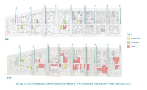
The Route 34 corridor development was an infamous part of New Haven history. Did it have residual effects on surrounding areas, specifically Crown Street? If so, how can it be measured? Here the map looks to explore the difference between pre and post corridor development. Though never fully completed, the projected relevance of the passageway in setting out a direction for the city must have had effects. In this map generated from Sanborn maps of the 20's and 70's, Crown street is mapped in its relevance to the automotive industry and lifestyle.